
Custom Minecraft models
We have done a lot of different projects with different sources of data and different scales. In some projects we use only Open Data, in others we use a combination of publicly available and proprietary data. We have made Minecraft models in all scales from one single building to a whole country. We use automated methods and processes, but we always adjust to make the final result fit the specific needs.
How to use Minecraft in the real world
Minecraft is used by professionals to involve and engage citizens, in education, to create awareness and for fun. Read more here.
Examples of our work
The Bialowieza forest in Minecraft

Vibcraft – the city of Viborg in Minecraft

The world’s largest limestone mines

Denmark in Minecraft

Mars

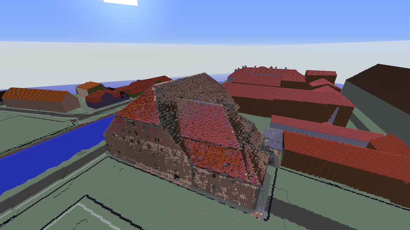
Single building measured by drones
Useful data
All custom Minecraft models are based on GIS and geospatial data. Data may be all kinds of geographically related data, like:
- Traditional GIS layers
- LiDAR point cloud or gridded elevation data
- Cadastral data
- Geological data
Contact us for further ideas on creative use of other datasets.
Our Minecraft services
Data validation
The resulting model depends on data quality and availability. Therefore every project starts with a good look into your data. We apply full scrutiny to ensure that quality is good enough to proceed, and we provide you with an overview of your data and the possibilities to convert them to Minecraft.
Various levels of detail
You deliver GIS / map data and a terrain model. We drape your map / GIS data over the elevation model, hence your map data will be raised to 3D and finally imported in to Minecraft.
If a 3D city model is available, we will use it to import the right heights and shapes of buildings.
If LiDAR data have been collected for your area of interest, we can fill in the gaps using automatisation on your point cloud.
Minecraft model using your geographic data
We calculate the model nation / region / city wide, so that you get ready-to-use Minecraft files.
Coordinate transformations
We make web-based coordinate transformation services, so that you get a relation between Minecraft and the real world to connect in-world and real life activities.
Navigation
Because of Minecraft’s relatively short viewing distance, it can be challenging to navigate in the maps. This is especially relevant when bigger Minecraft maps are in use, and also when users are professionals who are not normally Minecrafters, Therefore we provide overview maps of our Minecraft maps. The overview maps can be accessed using a standard web browser or mobile device, and will show coordinates in the model.
Counselling
GeoBoxers provide Minecraft maps and models that can be customized to suit your particular project. Our Minecraft services include ideas and guidance to help you along, while your data evolves into a social media of its own.
Contact Us På dansk om geodata i Minecraft (Danish)